Geolocate

Castiglione topographic map

Click on the map to display elevation.

About this map

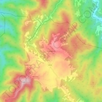
Name: Castiglione topographic map, elevation, terrain.

Location: Castiglione, Montereale, L'Aquila, Abruzzo, Italy (42.55181 13.19798 42.59181 13.23798)

Average elevation: 1,111 m

Minimum elevation: 909 m

Maximum elevation: 1,296 m

Gear up for your next adventure:

🥾Hiking Gaiters - Protect legs and shoes from mud, snow, and debris
🧣Evaporative Cooling Towel - Beat the heat during intense summer climbs
🕶️Polarized Sunglasses - Protect your eyes with durable polarized lenses
🎒Fully Waterproof Backpack - Total protection for photography gear and electronics
🛏️Sleeping Bag - Warm and compact sleeping bags for outdoor camping

As an Amazon Associate, this site earns from qualifying purchases at no extra cost to you.