Geolocate

Cauca topographic map

Click on the map to display elevation.

About this map

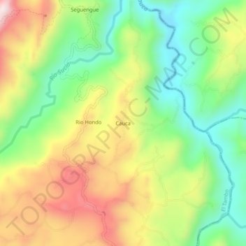
Name: Cauca topographic map, elevation, terrain.

Location: Cauca, El Tambo, Centro, Cauca, Colombia (2.54833 -76.80142 2.58833 -76.76142)

Average elevation: 1,541 m

Minimum elevation: 1,309 m

Maximum elevation: 1,847 m

Other topographic maps

Click on a map to view its topography, its elevation and its terrain.

Gear up for your next adventure:

🔨Vehicle Emergency Tool - Safety tool for remote road trips to trailheads
🛏️Camping Sleeping Mat - Comfortable mats for sleeping outdoors
🧥Thermal Fleece Jacket - Versatile insulation for changing mountain temperatures
💡LED Camping Lantern - Illuminate your campsite with long-lasting lanterns
Camping Tent - Weather-resistant tents suitable for 2 to 6 people

As an Amazon Associate, this site earns from qualifying purchases at no extra cost to you.