
Dayfield topographic map
Click on the map to display elevation.
About this map
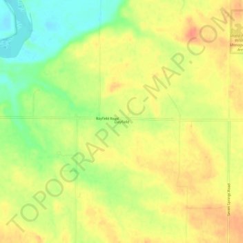
Name: Dayfield topographic map, elevation, terrain.
Location: Dayfield, Muscatine County, Iowa, United States (41.44503 -91.17126 41.48503 -91.13126)
Average elevation: 212 m
Minimum elevation: 184 m
Maximum elevation: 230 m
Other topographic maps
Click on a map to view its topography, its elevation and its terrain.
Wilton
United States > Iowa > Muscatine County
According to the United States Census Bureau, the city has a total area of 1.95 square miles (5.05 km2), all land. The city sits at an elevation of 679 feet.
Average elevation: 210 m