Geolocate

Lugoj topographic map

Click on the map to display elevation.

About this map

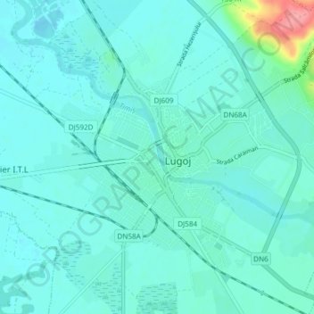
Name: Lugoj topographic map, elevation, terrain.

Location: Lugoj, Timiș, 305500, Romania (45.66253 21.87366 45.71089 21.94858)

Average elevation: 124 m

Minimum elevation: 112 m

Maximum elevation: 203 m

Gear up for your next adventure:

🧦Hiking Liner Socks - Thin base layer to prevent friction and blisters
🦟Insect Repellent - Keep mosquitoes and black flies away in wooded areas
🧳Compression Sacks - Maximize space in your backpack by shrinking gear
🛶Waterproof Dry Bags - Keep electronics and clothes dry during river crossings
🥾Hiking Shorts - Breathable shorts suitable for summer hikes

As an Amazon Associate, this site earns from qualifying purchases at no extra cost to you.