
Thank you for supporting this site ❤️
Make a donation
Make a donation
Gear up for your next adventure:
As an Amazon Associate, this site earns from qualifying purchases at no extra cost to you.
Mirand topographic map
Click on the map to display elevation.
Thank you for supporting this site ❤️
Make a donation
Make a donation
Gear up for your next adventure:
As an Amazon Associate, this site earns from qualifying purchases at no extra cost to you.
About this map
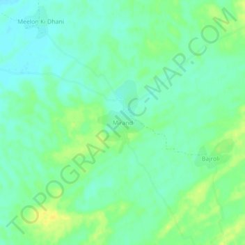
Name: Mirand topographic map, elevation, terrain.
Location: Mirand, Lachhmangarh Tehsil, Sikar, Rajasthan, India (27.66714 74.85062 27.70714 74.89062)
Average elevation: 362 m
Minimum elevation: 353 m
Maximum elevation: 374 m
Thank you for supporting this site ❤️
Make a donation
Make a donation
Gear up for your next adventure:
As an Amazon Associate, this site earns from qualifying purchases at no extra cost to you.