Geolocate

Hartsfield topographic map

Click on the map to display elevation.

About this map

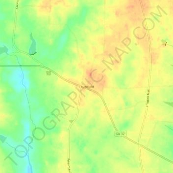
Name: Hartsfield topographic map, elevation, terrain.

Location: Hartsfield, Colquitt County, Georgia, 31756, United States (31.19685 -83.99601 31.23685 -83.95601)

Average elevation: 98 m

Minimum elevation: 75 m

Maximum elevation: 114 m

Other topographic maps

Click on a map to view its topography, its elevation and its terrain.

Funston

United States > Georgia > Colquitt County

Average elevation: 102 m

Berlin

United States > Georgia > Colquitt County

Average elevation: 71 m

Ellenton

United States > Georgia > Colquitt County

Average elevation: 77 m

Norman Park

United States > Georgia > Colquitt County

Average elevation: 100 m

Gear up for your next adventure:

🧥Thermal Fleece Jacket - Versatile insulation for changing mountain temperatures
🧥Waterproof Jacket - Lightweight rain jackets for hiking and outdoor activities
🧊Insulated Water Bottle - Keeps drinks cold in summer and prevents freezing in winter
🛌Insulated Sleeping Pad - Critical thermal barrier between you and the cold ground
🦌Outdoor Trail Camera - Monitor wildlife activity near your favorite spots

As an Amazon Associate, this site earns from qualifying purchases at no extra cost to you.