Geolocate

Agricola topographic map

Click on the map to display elevation.

About this map

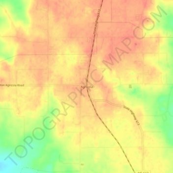
Name: Agricola topographic map, elevation, terrain.

Location: Agricola, George County, Mississippi, 39453, United States (30.78769 -88.54002 30.82769 -88.50002)

Average elevation: 61 m

Minimum elevation: 26 m

Maximum elevation: 75 m

Other topographic maps

Click on a map to view its topography, its elevation and its terrain.

Lucedale

United States > Mississippi > George County

Average elevation: 72 m

Lucedale

United States > Mississippi > George County

Average elevation: 72 m

Gear up for your next adventure:

👟Leg Gaiters - Keep debris, mud, and snow out of your boots
Family Camping Tent - Spacious tent suitable for family camping trips
🛏️Sleeping Bag - Warm and compact sleeping bags for outdoor camping
👟Trail Running Shoes - Agile footwear for fast-paced topographic exploration
🧢Sun Hat - Wide-brim hat for sun protection

As an Amazon Associate, this site earns from qualifying purchases at no extra cost to you.