Geolocate

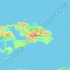
Sopa topographic map

Click on the map to display elevation.

About this map

Name: Sopa topographic map, elevation, terrain.

Location: Sopa, Raja Ampat, Southwest Papua, Western New Guinea, Indonesia (-2.40972 129.85833 -1.76972 130.49833)

Average elevation: 38 m

Minimum elevation: -1 m

Maximum elevation: 482 m

Other topographic maps

Click on a map to view its topography, its elevation and its terrain.

Gam Island

Indonesia > Southwest Papua > Raja Ampat

Average elevation: 1 m

Pulau Waigeo

Indonesia > Southwest Papua > Raja Ampat

The area of the island is 3,155 square kilometres (1,218 square miles); the highest elevations are 958-metre-high (3,143-foot) Buffalo Horn (Gunung Nok) and 939-metre-high (3,081-foot) Serodjil. From west to east, the island measures approximately 110 km (68 mi), north–south about 50 kilometres (31 miles).

Average elevation: 37 m

Pulau Batanta

Indonesia > Southwest Papua > Raja Ampat

Average elevation: 57 m

Pulau Mansuar

Indonesia > Southwest Papua > Raja Ampat > Kurkapa

Average elevation: 11 m

Gear up for your next adventure:

🧴Waterproofing Spray - Restore the DWR coating on jackets and tents
🐕Hiking Dog Pack - Let your canine companion carry their own water and food
🚲MTB Frame Bag - Carry tools and maps directly on your bicycle frame
🧭GPS Tracker - Track your location in remote areas safely
🥾Lightweight Hiking Boots - Boots for comfort and mobility on long hikes

As an Amazon Associate, this site earns from qualifying purchases at no extra cost to you.