Geolocate

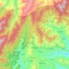
Hucab topographic map

Click on the map to display elevation.

About this map
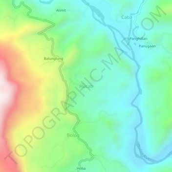
Name: Hucab topographic map, elevation, terrain.

Location: Hucab, Ifugao, Cordillera Administrative Region, 3604, Philippines (16.73872 121.12880 16.77872 121.16880)

Average elevation: 573 m

Minimum elevation: 326 m

Maximum elevation: 1,131 m

Other topographic maps

Click on a map to view its topography, its elevation and its terrain.
Banaue

Philippines > Ifugao

Average elevation: 1,419 m

Magat River

Philippines > Ifugao

Average elevation: 159 m

Hapao-Ibulao

Philippines > Ifugao > Bokiawan

Average elevation: 1,081 m

Banaue Rice Terraces

Philippines > Ifugao > Banaue > Viewpoint > Pan-ngat

Average elevation: 1,313 m

Bilong

Philippines > Ifugao > Kiangan

Average elevation: 983 m

Ibulao River

Philippines > Ifugao > Hapid

Average elevation: 587 m

Batad Rice Terraces

Philippines > Ifugao > Banaue > Batad

Average elevation: 1,003 m

Banaue

Philippines > Ifugao

Average elevation: 1,448 m

Banaue Rice Terraces

Philippines > Ifugao > Banaue > Viewpoint > Pan-ngat

Average elevation: 1,313 m

Banaue Rice Terraces

Philippines > Ifugao > Banaue > Poblacion

Average elevation: 1,313 m

Banaue Rice Terraces

Philippines > Ifugao > Banaue > Viewpoint > Pan-ngat

Average elevation: 1,313 m

Banaue

Philippines > Ifugao

Average elevation: 1,448 m

Banaue

Philippines > Ifugao

Average elevation: 1,419 m

Bilong

Philippines > Ifugao > Kiangan

Average elevation: 983 m

Gear up for your next adventure:

🗺️Topographic Maps - Detailed maps to explore trails, mountains, and wilderness areas
🧼Travel Hand Sanitizer - Keep hands clean when water is scarce
🧢Beanie Hat - Keep your head warm in cold weather
🧣Merino Neck Gaiter - Protects against wind, sun, and cold at high altitudes
🧰Survival Kit - Essential gear for emergencies in the wilderness

As an Amazon Associate, this site earns from qualifying purchases at no extra cost to you.