Geolocate

Los Yesos topographic map

Click on the map to display elevation.

About this map

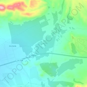
Name: Los Yesos topographic map, elevation, terrain.

Location: Los Yesos, Tabernas, Almeria, Andalusia, Spain (37.07148 -2.31835 37.11148 -2.27835)

Average elevation: 532 m

Minimum elevation: 478 m

Maximum elevation: 716 m

Gear up for your next adventure:

🧥Waterproof Hiking Jacket - Protect yourself from rain and wind while hiking
🧊Insulated Water Bottle - Keeps drinks cold in summer and prevents freezing in winter
Bushcraft Tarp - Versatile emergency shelter or gear protection
🧥Waterproof Pants - Keep dry during rainy hiking conditions
🧭GPS Outdoor Watch - Smart watch for navigation and fitness tracking in nature

As an Amazon Associate, this site earns from qualifying purchases at no extra cost to you.