Geolocate

Zege topographic map

Click on the map to display elevation.

About this map

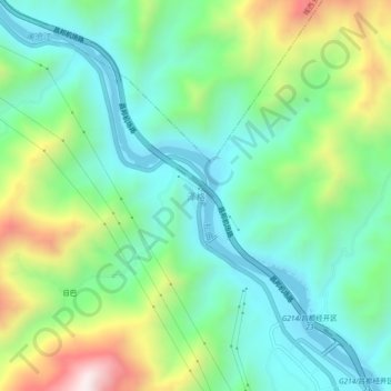
Name: Zege topographic map, elevation, terrain.

Location: Zege, Chamdo City, Tibet, China (30.97576 97.30614 31.01576 97.34614)

Average elevation: 3,395 m

Minimum elevation: 3,158 m

Maximum elevation: 3,942 m

Gear up for your next adventure:

🛌Insulated Sleeping Pad - Critical thermal barrier between you and the cold ground
Camping Groundsheet - Protect your tent from moisture and dirt
🧤Thermal Hiking Gloves - Grip-enhanced gloves for cold-weather altitude trekking
🦟Insect Repellent - Keep mosquitoes and black flies away in wooded areas
🥫Freeze-Dried Meals - Lightweight, high-calorie nutrition for multi-day treks

As an Amazon Associate, this site earns from qualifying purchases at no extra cost to you.