
Thank you for supporting this site ❤️
Make a donation
Make a donation
Gear up for your next adventure:
As an Amazon Associate, this site earns from qualifying purchases at no extra cost to you.
Mandola topographic map
Click on the map to display elevation.
Thank you for supporting this site ❤️
Make a donation
Make a donation
Gear up for your next adventure:
As an Amazon Associate, this site earns from qualifying purchases at no extra cost to you.
About this map
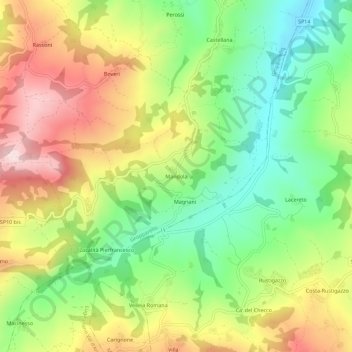
Name: Mandola topographic map, elevation, terrain.
Location: Mandola, Gropparello, Piacenza, Emilia-Romagna, 29025, Italia (44.77993 9.70633 44.81993 9.74633)
Average elevation: 451 m
Minimum elevation: 275 m
Maximum elevation: 671 m
Thank you for supporting this site ❤️
Make a donation
Make a donation
Gear up for your next adventure:
As an Amazon Associate, this site earns from qualifying purchases at no extra cost to you.