Geolocate

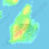
McKinley Estates topographic map

Click on the map to display elevation.

About this map

Name: McKinley Estates topographic map, elevation, terrain.

Location: McKinley Estates, Portland, Cumberland County, Maine, 04109, United States (43.66425 -70.21588 43.70425 -70.17588)

Average elevation: 2 m

Minimum elevation: -2 m

Maximum elevation: 37 m

Other topographic maps

Click on a map to view its topography, its elevation and its terrain.

04101

United States > Maine > Cumberland County > Portland

Average elevation: 10 m

Gear up for your next adventure:

🥾Trail Running Shoes - Lightweight and durable shoes for trail running
🏕️Camping Hammock - Integrated protection for sleeping between trees
🧥Fleece Jacket - Warm and lightweight jacket for layering
🥾Waterproof Hiking Boots - Essential footwear for rugged terrain and wet Canadian trails
👖Convertible Hiking Pants - Zip-off legs to adapt to changing weather conditions

As an Amazon Associate, this site earns from qualifying purchases at no extra cost to you.