Geolocate

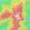
Salingueux topographic map

Click on the map to display elevation.

About this map

Name: Salingueux topographic map, elevation, terrain.

Location: Salingueux, Cornimont, Épinal, Vosges, Grand Est, France métropolitaine, 88310, France (47.93750 6.79644 47.97750 6.83644)

Average elevation: 664 m

Minimum elevation: 464 m

Maximum elevation: 983 m

Other topographic maps

Click on a map to view its topography, its elevation and its terrain.

Le Xoulces

France > Grand Est > Vosges > Cornimont

Average elevation: 865 m

REFUGE DU GRAND VENTRON

France > Grand Est > Vosges > Cornimont

Average elevation: 1,011 m

Gear up for your next adventure:

🔋Solar Power Bank - Keep your GPS and devices charged during long outdoor trips
🕶️Polarized Sunglasses - Reduces glare from snow and water at high elevations
⛺Camping Groundsheet - Protect your tent from moisture and dirt
🧥Waterproof Jacket - Lightweight rain jackets for hiking and outdoor activities
🧢Outdoor Visor - Breathable visor for sunny hikes

As an Amazon Associate, this site earns from qualifying purchases at no extra cost to you.