Geolocate

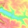
Mylivtsi topographic map

Click on the map to display elevation.

About this map

Name: Mylivtsi topographic map, elevation, terrain.

Location: Mylivtsi, Nahirianka Rural Hromada, Chortkiv Raion, Ternopil Oblast, 48564, Ukraine (48.87451 25.78275 48.89331 25.83778)

Average elevation: 244 m

Minimum elevation: 188 m

Maximum elevation: 308 m

Other topographic maps

Click on a map to view its topography, its elevation and its terrain.
Hodiv

Ukraine > Ternopil Oblast

Average elevation: 371 m

Gear up for your next adventure:

⛺Backpacking Tent - Lightweight tent for long-distance hiking trips
🥾Approach Boots - Comfortable boots for hiking and climbing approaches
🛌Down Sleeping Bag - Superior warmth-to-weight ratio for cold nights
💧Filtered Water Bottle - Safe drinking water on the go
⛺Bushcraft Tarp - Versatile emergency shelter or gear protection

As an Amazon Associate, this site earns from qualifying purchases at no extra cost to you.