
Thank you for supporting this site ❤️
Make a donation
Make a donation
Gear up for your next adventure:
As an Amazon Associate, this site earns from qualifying purchases at no extra cost to you.
Tirúa topographic map
Click on the map to display elevation.
Thank you for supporting this site ❤️
Make a donation
Make a donation
Gear up for your next adventure:
As an Amazon Associate, this site earns from qualifying purchases at no extra cost to you.
About this map
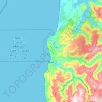
Name: Tirúa topographic map, elevation, terrain.
Location: Tirúa, Provincia de Arauco, Biobío Region, Chile (-38.49251 -73.53001 -38.11255 -73.23524)
Average elevation: 133 m
Minimum elevation: -2 m
Maximum elevation: 757 m
Thank you for supporting this site ❤️
Make a donation
Make a donation
Gear up for your next adventure:
As an Amazon Associate, this site earns from qualifying purchases at no extra cost to you.