
Belmont topographic map
Interactive map
Click on the map to display elevation.
About this map
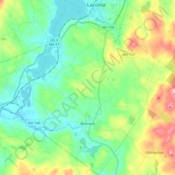
Name: Belmont topographic map, elevation, terrain.
Location: Belmont, Belknap County, New Hampshire, United States (43.40969 -71.54708 43.53089 -71.39692)
Average elevation: 232 m
Minimum elevation: 139 m
Maximum elevation: 462 m
Other topographic maps
Click on a map to view its topography, its elevation and its terrain.
Halfmoon Lake
United States > New Hampshire > Belknap County > Alton
Halfmoon Lake, Alton, Belknap County, New Hampshire, United States
Average elevation: 213 m