Geolocate

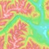
White Man Pass topographic map

Click on the map to display elevation.

About this map

Name: White Man Pass topographic map, elevation, terrain.

Location: White Man Pass, Area F (Columbia Lake/Windermere Lake), Regional District of East Kootenay, British Columbia, Canada (50.77904 -115.49492 50.77914 -115.49482)

Average elevation: 2,199 m

Minimum elevation: 1,908 m

Maximum elevation: 2,654 m

Other topographic maps

Click on a map to view its topography, its elevation and its terrain.
Gear up for your next adventure:

🔋Solar Power Bank - Keep your GPS and devices charged during long outdoor trips
🦯Trekking Poles - Reduced impact on joints for steep topographic climbs
⛺Camping Tent - Weather-resistant tents suitable for 2 to 6 people
🧰Emergency Multi-Tool - Compact multi-tool for outdoor survival
☕Camping Coffee Maker - Brew fresh coffee anywhere on the topographic map

As an Amazon Associate, this site earns from qualifying purchases at no extra cost to you.