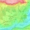
Vert-le-Grand topographic map
Click on the map to display elevation.
About this map

Name: Vert-le-Grand topographic map, elevation, terrain.
Average elevation: 78 m
Minimum elevation: 42 m
Maximum elevation: 120 m
Other topographic maps
Click on a map to view its topography, its elevation and its terrain.

Paris Basin
France > Ile-de-France > Essonne > Bièvres
The landscape is one of very broad valleys (flood plains), modest watershed hills and well-drained plateaux of comparatively little altitude. In the south-east and east the plain of Champagne and the Seuil de Bourgogne (Threshold of Burgundy) differential erosion of the strata has left low scarps with the dip…
Average elevation: 126 m