Geolocate

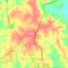
Rhodes topographic map

Click on the map to display elevation.

About this map

Name: Rhodes topographic map, elevation, terrain.

Location: Rhodes, Butler County, Alabama, 36456, United States (31.55822 -86.71164 31.59822 -86.67164)

Average elevation: 86 m

Minimum elevation: 62 m

Maximum elevation: 144 m

Other topographic maps

Click on a map to view its topography, its elevation and its terrain.
McKenzie

United States > Alabama > Butler County

Average elevation: 116 m

Gear up for your next adventure:

🔋Lithium AA Batteries - Long-lasting power that performs in extreme cold
🩹Compact First Aid Kit - Pre-packed essentials for common trail injuries
🔭Compact Monocular - One-handed bird watching and trail spotting
⛺Lightweight Camping Tent - Portable shelter optimized for Canadian backcountry camping
🔥Camping Stove - Portable stoves to cook outdoors with ease

As an Amazon Associate, this site earns from qualifying purchases at no extra cost to you.