Geolocate

Toro topographic map

Click on the map to display elevation.

About this map

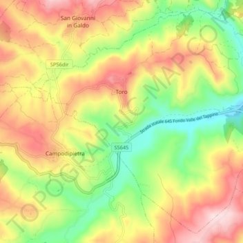
Name: Toro topographic map, elevation, terrain.

Location: Toro, Campobasso, Molise, 86018, Italy (41.53697 14.73591 41.59295 14.81724)

Average elevation: 485 m

Minimum elevation: 312 m

Maximum elevation: 669 m

Gear up for your next adventure:

🔦UV Flashlight - Detect minerals or specific insects in the dark
🎒Hiking Daypack - Lightweight and durable backpacks for day trips and excursions
💡LED Camping Lantern - Illuminate your campsite with long-lasting lanterns
💧Hydration Bladder - Hands-free hydration solution for long treks
📷Outdoor Action Camera - Capture high-elevation views and rugged adventures

As an Amazon Associate, this site earns from qualifying purchases at no extra cost to you.