
Thank you for supporting this site ❤️
Make a donation
Make a donation
Gear up for your next adventure:
As an Amazon Associate, this site earns from qualifying purchases at no extra cost to you.
Béarn topographic map
Click on the map to display elevation.
Thank you for supporting this site ❤️
Make a donation
Make a donation
Gear up for your next adventure:
As an Amazon Associate, this site earns from qualifying purchases at no extra cost to you.
About this map
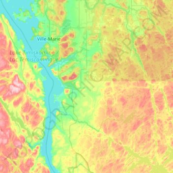
Name: Béarn topographic map, elevation, terrain.
Location: Béarn, Témiscamingue, Abitibi-Témiscamingue, Quebec, Canada (47.12749 -79.37255 47.34916 -78.87297)
Average elevation: 268 m
Minimum elevation: 172 m
Maximum elevation: 432 m
Thank you for supporting this site ❤️
Make a donation
Make a donation
Gear up for your next adventure:
As an Amazon Associate, this site earns from qualifying purchases at no extra cost to you.
Other topographic maps
Click on a map to view its topography, its elevation and its terrain.
Lac du Bois Franc
Canada > Quebec > Témiscamingue > Les Lacs-du-Témiscamingue
Average elevation: 398 m