
Bay St. Louis topographic map
Click on the map to display elevation.
Bay St. Louis
USGS topographic maps show a common 25-foot (7.6 m) elevation contour line running throughout a ridge along the former routing of Highway 90 (Old Spanish Trail) on the western edge of the city. As higher ground, this area was spared inundation from the storm surge of Hurricane Katrina.
About this map
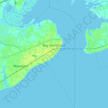
Name: Bay St. Louis topographic map, elevation, terrain.
Location: Bay St. Louis, Hancock County, Mississippi, United States (30.23938 -89.43455 30.36622 -89.30626)
Average elevation: 2 m
Minimum elevation: -3 m
Maximum elevation: 16 m