Geolocate

Port Arthur topographic map

Click on the map to display elevation.

About this map

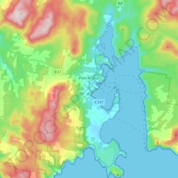
Name: Port Arthur topographic map, elevation, terrain.

Location: Port Arthur, Tasman, Tasmania, 7182, Australia (-43.20832 147.79233 -43.09321 147.88457)

Average elevation: 153 m

Minimum elevation: -2 m

Maximum elevation: 499 m

Other topographic maps

Click on a map to view its topography, its elevation and its terrain.

Tasman Peninsula

Australia > Tasmania > Tasman > Fortescue

Average elevation: 167 m

Gear up for your next adventure:

🔦LED Flashlight - Powerful and long-lasting flashlight for camping and emergencies
🥾Trail Hiking Boots - Supportive boots for rough trails
🧥Fleece Jacket - Warm and lightweight jacket for layering
Bushcraft Tarp - Versatile emergency shelter or gear protection
🛰️Satellite Messenger - Emergency communication for areas with no cell service

As an Amazon Associate, this site earns from qualifying purchases at no extra cost to you.