
勒村 topographic map
Interactive map
Click on the map to display elevation.
About this map
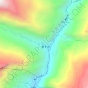
Name: 勒村 topographic map, elevation, terrain.
Location: 勒村, Tsona Dzong, 山南市 ལྷོ་ཁ་ས་ཁུལ།, Tibet, Chine (27.79933 91.72967 27.83933 91.76967)
Average elevation: 3,017 m
Minimum elevation: 2,334 m
Maximum elevation: 4,058 m