Geolocate

Joanet topographic map

Click on the map to display elevation.

About this map

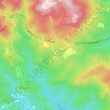
Name: Joanet topographic map, elevation, terrain.

Location: Joanet, Arbúcies, la Selva, Gerona, Cataluña, 17401, España (41.82382 2.50785 41.86382 2.54785)

Average elevation: 517 m

Minimum elevation: 300 m

Maximum elevation: 795 m

Gear up for your next adventure:

👟Sport Hiking Sandals - Breathable footwear for water crossings and camp rest
🪑Insulated Seat Pad - Protect your seat from cold rocks and wet logs
🧤Thermal Hiking Gloves - Grip-enhanced gloves for cold-weather altitude trekking
🛌Down Sleeping Bag - Superior warmth-to-weight ratio for cold nights
🥾Mountain Trail Shoes - High-traction shoes for mountain trails

As an Amazon Associate, this site earns from qualifying purchases at no extra cost to you.