Geolocate

Fresnillo topographic map

Click on the map to display elevation.

About this map

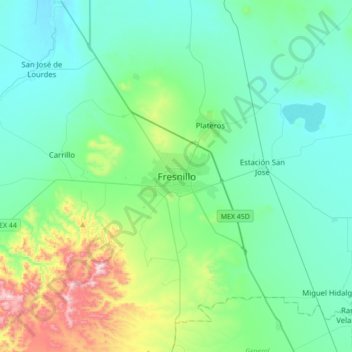
Name: Fresnillo topographic map, elevation, terrain.

Location: Fresnillo, Zacatecas, 99000, Mexico (23.02113 -103.03291 23.34113 -102.71291)

Average elevation: 2,187 m

Minimum elevation: 2,031 m

Maximum elevation: 2,837 m

Gear up for your next adventure:

🧊Portable Cooler - Keep food and drinks cold during outdoor adventures
🥾Light Hiking Boots - Lightweight and comfortable boots for day hikes
🥾Mountain Hiking Boots - High-traction boots for rocky terrain
🛌Insulated Sleeping Pad - Critical thermal barrier between you and the cold ground
🧶550 Survival Paracord - Versatile utility cord for emergency repairs and rigging

As an Amazon Associate, this site earns from qualifying purchases at no extra cost to you.