
Thank you for supporting this site ❤️
Make a donation
Make a donation
Gear up for your next adventure:
As an Amazon Associate, this site earns from qualifying purchases at no extra cost to you.
Baalsbruggen topographic map
Click on the map to display elevation.
Thank you for supporting this site ❤️
Make a donation
Make a donation
Gear up for your next adventure:
As an Amazon Associate, this site earns from qualifying purchases at no extra cost to you.
About this map
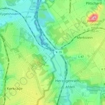
Name: Baalsbruggen topographic map, elevation, terrain.
Location: Baalsbruggen, Kerkrade, Limburg, Nederland, 6464 EK, Nederland (50.85922 6.06617 50.89922 6.10617)
Average elevation: 134 m
Minimum elevation: 90 m
Maximum elevation: 230 m
Thank you for supporting this site ❤️
Make a donation
Make a donation
Gear up for your next adventure:
As an Amazon Associate, this site earns from qualifying purchases at no extra cost to you.