Geolocate

Alcuneza topographic map

Click on the map to display elevation.

About this map

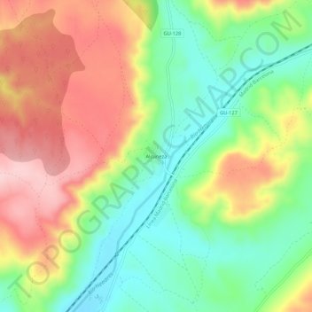
Name: Alcuneza topographic map, elevation, terrain.

Location: Alcuneza, Sigüenza, Guadalajara, Castilla-La Mancha, España (41.08489 -2.62651 41.12489 -2.58651)

Average elevation: 1,086 m

Minimum elevation: 995 m

Maximum elevation: 1,197 m

Other topographic maps

Click on a map to view its topography, its elevation and its terrain.

Riosalido

España > Castilla-La Mancha > Sigüenza

Average elevation: 1,041 m

Gear up for your next adventure:

🛶Canoe Life Vest - Safety vest for water sports
📷Outdoor Action Camera - Capture high-elevation views and rugged adventures
🧤Thermal Hiking Gloves - Grip-enhanced gloves for cold-weather altitude trekking
🥾Hiking Shorts - Breathable shorts suitable for summer hikes
🚲Heavy Duty Bike Lock - Secure your bike at the trailhead or during stops

As an Amazon Associate, this site earns from qualifying purchases at no extra cost to you.