
Thank you for supporting this site ❤️
Make a donation
Make a donation
Gear up for your next adventure:
As an Amazon Associate, this site earns from qualifying purchases at no extra cost to you.
Kalbarre topographic map
Click on the map to display elevation.
Thank you for supporting this site ❤️
Make a donation
Make a donation
Gear up for your next adventure:
As an Amazon Associate, this site earns from qualifying purchases at no extra cost to you.
About this map
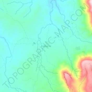
Name: Kalbarre topographic map, elevation, terrain.
Location: Kalbarre, Sheikh District, Sahil, Somalia (9.88672 45.55279 9.92672 45.59279)
Average elevation: 1,218 m
Minimum elevation: 1,128 m
Maximum elevation: 1,523 m
Thank you for supporting this site ❤️
Make a donation
Make a donation
Gear up for your next adventure:
As an Amazon Associate, this site earns from qualifying purchases at no extra cost to you.