Geolocate

Balmenhorn topographic map

Click on the map to display elevation.

About this map

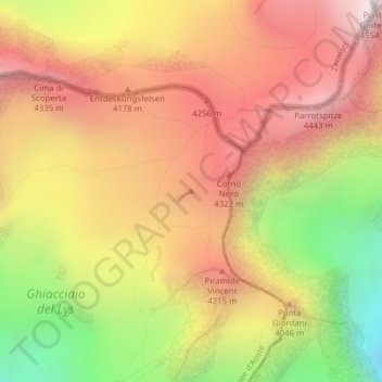
Name: Balmenhorn topographic map, elevation, terrain.

Location: Balmenhorn, Gressoney-La-Trinité, Aosta Valley, Italy (45.91379 7.85808 45.91389 7.85818)

Average elevation: 3,928 m

Minimum elevation: 3,099 m

Maximum elevation: 4,551 m

Gear up for your next adventure:

🧴Sunscreen SPF - Broad-spectrum sunscreen for outdoor activities
🥾Hiking Leggings - Comfortable leggings for outdoor activities
🚲MTB Frame Bag - Carry tools and maps directly on your bicycle frame
📷Outdoor Action Camera - Capture high-elevation views and rugged adventures
🥫Freeze-Dried Meals - Lightweight, high-calorie nutrition for multi-day treks

As an Amazon Associate, this site earns from qualifying purchases at no extra cost to you.