Geolocate

Kojsko topographic map

Click on the map to display elevation.

About this map

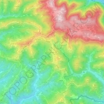
Name: Kojsko topographic map, elevation, terrain.

Location: Kojsko, Brestje, Brda, 5211, Slovenia (45.98665 13.55457 46.02665 13.59457)

Average elevation: 224 m

Minimum elevation: 77 m

Maximum elevation: 417 m

Gear up for your next adventure:

🧦Crew Hiking Socks - Comfortable socks for long-distance hikes
🎒Fully Waterproof Backpack - Total protection for photography gear and electronics
🎒Hiking Backpack - Lightweight and ergonomic backpacks for day hikes or multi-day treks
🧥Waterproof Pants - Keep dry during rainy hiking conditions
Camping Groundsheet - Protect your tent from moisture and dirt

As an Amazon Associate, this site earns from qualifying purchases at no extra cost to you.