Geolocate

Kilgoris topographic map

Click on the map to display elevation.

About this map

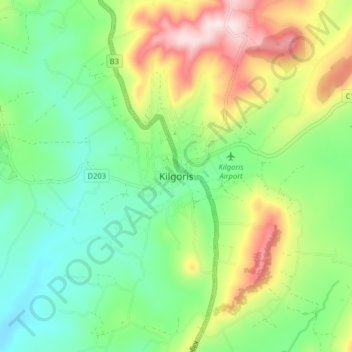
Name: Kilgoris topographic map, elevation, terrain.

Location: Kilgoris, Shankoe ward, Transmara West, Narok, Kenya (-1.04839 34.84001 -0.96839 34.92001)

Average elevation: 1,823 m

Minimum elevation: 1,656 m

Maximum elevation: 2,133 m

Gear up for your next adventure:

🧥Softshell Jacket - Windproof and breathable jacket for hiking
🥾Trail Running Boots - Durable shoes designed for trail running
🦶Hiking Shoe Insoles - Added support for high arches and long days on feet
🔋Lithium AA Batteries - Long-lasting power that performs in extreme cold
🥾Waterproof Trail Shoes - Shoes designed to handle wet terrain

As an Amazon Associate, this site earns from qualifying purchases at no extra cost to you.