
Zwota topographic map
Interactive map
Click on the map to display elevation.
About this map
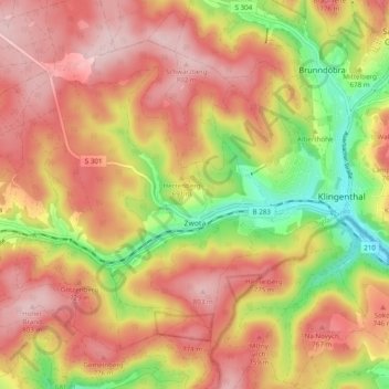
Name: Zwota topographic map, elevation, terrain.
Location: Zwota, Klingenthal, Vogtlandkreis, Sachsen, 08267, Deutschland (50.33373 12.36468 50.38308 12.46208)
Average elevation: 695 m
Minimum elevation: 538 m
Maximum elevation: 808 m
Other topographic maps
Click on a map to view its topography, its elevation and its terrain.
Mühlleithen
Deutschland > Sachsen > Vogtlandkreis > Klingenthal
Mühlleithen, Klingenthal, Vogtlandkreis, Sachsen, 08248, Deutschland
Average elevation: 824 m
Kiel
Deutschland > Sachsen > Vogtlandkreis > Klingenthal
Kiel, Klingenthal, Vogtlandkreis, Sachsen, 08248, Deutschland
Average elevation: 843 m