
Thank you for supporting this site ❤️
Make a donation
Make a donation
Gear up for your next adventure:
As an Amazon Associate, this site earns from qualifying purchases at no extra cost to you.
Villano topographic map
Click on the map to display elevation.
Thank you for supporting this site ❤️
Make a donation
Make a donation
Gear up for your next adventure:
As an Amazon Associate, this site earns from qualifying purchases at no extra cost to you.
About this map
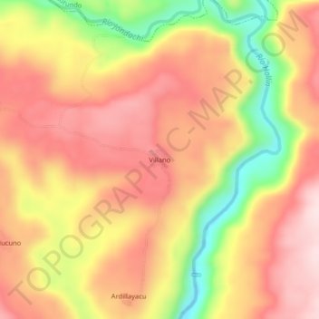
Name: Villano topographic map, elevation, terrain.
Location: Villano, San Pablo de Ushpayacu, Archidona, Napo, Ecuador (-0.89956 -77.74615 -0.85956 -77.70615)
Average elevation: 748 m
Minimum elevation: 540 m
Maximum elevation: 881 m
Thank you for supporting this site ❤️
Make a donation
Make a donation
Gear up for your next adventure:
As an Amazon Associate, this site earns from qualifying purchases at no extra cost to you.