Geolocate

Dram topographic map

Click on the map to display elevation.

About this map

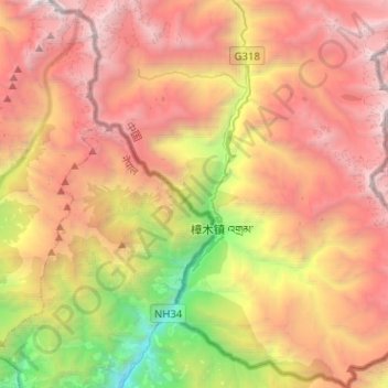
Name: Dram topographic map, elevation, terrain.

Location: Dram, Nyalam County, Shigatse Prefecture, Tibet, China (27.89981 85.89596 28.12328 86.12616)

Average elevation: 3,859 m

Minimum elevation: 1,275 m

Maximum elevation: 6,216 m

Gear up for your next adventure:

🧥Softshell Jacket - Windproof and breathable jacket for hiking
🔋Lithium AA Batteries - Long-lasting power that performs in extreme cold
🥾Trekking Poles - Adjustable trekking poles to reduce knee stress and improve stability
🧰Survival Kit - Essential gear for emergencies in the wilderness
🦶Anti-Blister Balm - Prevents friction and hotspots during long ascents

As an Amazon Associate, this site earns from qualifying purchases at no extra cost to you.