
Thank you for supporting this site ❤️
Make a donation
Make a donation
Gear up for your next adventure:
As an Amazon Associate, this site earns from qualifying purchases at no extra cost to you.
Monigong topographic map
Click on the map to display elevation.
Thank you for supporting this site ❤️
Make a donation
Make a donation
Gear up for your next adventure:
As an Amazon Associate, this site earns from qualifying purchases at no extra cost to you.
About this map
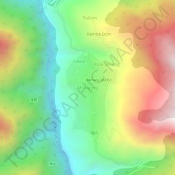
Name: Monigong topographic map, elevation, terrain.
Location: Monigong, Monigong EAC, Shi Yomi, Arunachal Pradesh, India (28.76373 94.25855 28.80373 94.29855)
Average elevation: 2,048 m
Minimum elevation: 1,574 m
Maximum elevation: 2,712 m
Thank you for supporting this site ❤️
Make a donation
Make a donation
Gear up for your next adventure:
As an Amazon Associate, this site earns from qualifying purchases at no extra cost to you.