
Thank you for supporting this site ❤️
Make a donation
Make a donation
Gear up for your next adventure:
As an Amazon Associate, this site earns from qualifying purchases at no extra cost to you.
Tojeira topographic map
Click on the map to display elevation.
Thank you for supporting this site ❤️
Make a donation
Make a donation
Gear up for your next adventure:
As an Amazon Associate, this site earns from qualifying purchases at no extra cost to you.
About this map
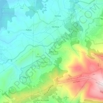
Name: Tojeira topographic map, elevation, terrain.
Location: Tojeira, Vilar, Cadaval, Lisbon, 2550-077, Portugal (39.16698 -9.10639 39.20698 -9.06639)
Average elevation: 235 m
Minimum elevation: 54 m
Maximum elevation: 655 m
Thank you for supporting this site ❤️
Make a donation
Make a donation
Gear up for your next adventure:
As an Amazon Associate, this site earns from qualifying purchases at no extra cost to you.