Geolocate

Carron topographic map

Click on the map to display elevation.

About this map

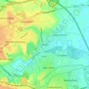
Name: Carron topographic map, elevation, terrain.

Location: Carron, Falkirk, Scotland, FK2 8DS, United Kingdom (56.00457 -3.81294 56.04457 -3.77294)

Average elevation: 16 m

Minimum elevation: 2 m

Maximum elevation: 37 m

Gear up for your next adventure:

🥾Waterproof Hiking Boots - Essential footwear for rugged terrain and wet Canadian trails
💡Solar Camping Lamp - Eco-friendly lighting for campsites
🧭GPS Outdoor Watch - Smart watch for navigation and fitness tracking in nature
🧴Sunscreen SPF - Broad-spectrum sunscreen for outdoor activities
🔋Lithium AA Batteries - Long-lasting power that performs in extreme cold

As an Amazon Associate, this site earns from qualifying purchases at no extra cost to you.