
Thank you for supporting this site ❤️
Make a donation
Make a donation
Gear up for your next adventure:
As an Amazon Associate, this site earns from qualifying purchases at no extra cost to you.
Alvao topographic map
Click on the map to display elevation.
Thank you for supporting this site ❤️
Make a donation
Make a donation
Gear up for your next adventure:
As an Amazon Associate, this site earns from qualifying purchases at no extra cost to you.
About this map
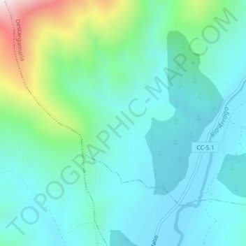
Name: Alvao topographic map, elevation, terrain.
Location: Alvao, Descargamaría, Cáceres, Extremadura, 10865, Spanje (40.26586 -6.53700 40.28586 -6.51700)
Average elevation: 574 m
Minimum elevation: 428 m
Maximum elevation: 1,113 m
Thank you for supporting this site ❤️
Make a donation
Make a donation
Gear up for your next adventure:
As an Amazon Associate, this site earns from qualifying purchases at no extra cost to you.