Geolocate

Waghodia topographic map

Click on the map to display elevation.

About this map

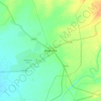
Name: Waghodia topographic map, elevation, terrain.

Location: Waghodia, Vagodhia Taluka, Vadodara District, Gujarat, 391760, India (22.26433 73.36168 22.34433 73.44168)

Average elevation: 54 m

Minimum elevation: 42 m

Maximum elevation: 74 m

Gear up for your next adventure:

Family Camping Tent - Spacious tent suitable for family camping trips
🚲Heavy Duty Bike Lock - Secure your bike at the trailhead or during stops
🎒Backpack Rain Cover - External shield to keep your entire pack dry
🧭Orienteering Kit - Tools for map reading and navigation in the wild
🧥Packable Rain Jacket - Breathable waterproof layer for unpredictable weather

As an Amazon Associate, this site earns from qualifying purchases at no extra cost to you.