
Grand Anse topographic map
Interactive map
Click on the map to display elevation.
About this map
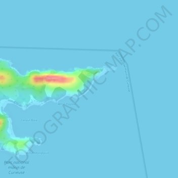
Name: Grand Anse topographic map, elevation, terrain.
Average elevation: 4 m
Minimum elevation: 0 m
Maximum elevation: 96 m
Other topographic maps
Click on a map to view its topography, its elevation and its terrain.
Anse Georgette
Seychelles > Praslin group > Baie Saint Anne District
Anse Georgette, Baie Saint Anne District, Praslin group, Seychelles
Average elevation: 19 m