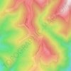
Novaci topographic map
Click on the map to display elevation.
Novaci
Only 12 km (7.5 mi) from Novaci, passing the Transalpina (DN67C) road is Rânca (1,600 m (5,200 ft) altitude), a newly developed resort surrounded by mountain peaks and tremendous beauty. From this place is a view of the Parângu Mare peak and when the weather is good you can see the Peleaga peak of the Retezat Mountains. During winter there are two ski slopes with low and medium difficulty.
About this map

Name: Novaci topographic map, elevation, terrain.
Location: Novaci, Gorj, Romania (45.12406 23.57349 45.35020 23.72628)
Average elevation: 1,056 m
Minimum elevation: 345 m
Maximum elevation: 2,502 m
Other topographic maps
Click on a map to view its topography, its elevation and its terrain.