Geolocate

Attal topographic map

Click on the map to display elevation.

About this map

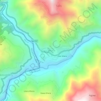
Name: Attal topographic map, elevation, terrain.

Location: Attal, Tyuni, Dehradun District, Uttarakhand, India (30.81176 77.74673 30.85176 77.78673)

Average elevation: 1,181 m

Minimum elevation: 762 m

Maximum elevation: 1,997 m

Gear up for your next adventure:

🧣Evaporative Cooling Towel - Beat the heat during intense summer climbs
🥾Waterproof Hiking Boots - Boots keeping your feet dry in wet conditions
🥤Collapsible Travel Cup - Saves space and weight in your mess kit
👟Sport Hiking Sandals - Breathable footwear for water crossings and camp rest
💧Filtered Water Bottle - Safe drinking water on the go

As an Amazon Associate, this site earns from qualifying purchases at no extra cost to you.