Geolocate

Ipswich topographic map

Click on the map to display elevation.

About this map

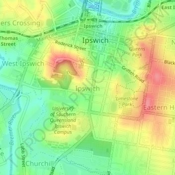
Name: Ipswich topographic map, elevation, terrain.

Location: Ipswich, Ipswich City, Queensland, 4305, Australia (-27.63648 152.74841 -27.61024 152.77159)

Average elevation: 37 m

Minimum elevation: 1 m

Maximum elevation: 79 m

Other topographic maps

Click on a map to view its topography, its elevation and its terrain.

White Rock

Australia > Queensland > Ipswich City

Average elevation: 114 m

Spring Mountain

Australia > Queensland > Ipswich City

Average elevation: 190 m

Stanton Cross

Australia > Queensland > Ipswich City

Average elevation: 28 m

Mount Grey

Australia > Queensland > Ipswich City

Average elevation: 231 m

Gear up for your next adventure:

🧰Survival Kit - Essential gear for emergencies in the wilderness
🌡️Emergency Mylar Blankets - Compact thermal protection for unexpected nights outdoors
🧦Hiking Liner Socks - Thin base layer to prevent friction and blisters
Lightweight Backpacking Tent - Compact tent for efficient hiking trips
💧Filtered Water Bottle - Safe drinking water on the go

As an Amazon Associate, this site earns from qualifying purchases at no extra cost to you.