Geolocate

Gaflenz topographic map

Click on the map to display elevation.

About this map

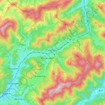
Name: Gaflenz topographic map, elevation, terrain.

Location: Gaflenz, Bezirk Steyr-Land, 3334, Austria (47.85065 14.63535 47.93532 14.77195)

Average elevation: 674 m

Minimum elevation: 391 m

Maximum elevation: 1,150 m

Gear up for your next adventure:

👟Sport Hiking Sandals - Breathable footwear for water crossings and camp rest
🧥Packable Rain Jacket - Breathable waterproof layer for unpredictable weather
🧴Sunscreen SPF - Broad-spectrum sunscreen for outdoor activities
🛌Down Sleeping Bag - Superior warmth-to-weight ratio for cold nights
🥘Camping Cookware Set - Compact nesting pots and pans for trail cooking

As an Amazon Associate, this site earns from qualifying purchases at no extra cost to you.