Geolocate

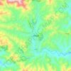
Bhumikasthan topographic map

Click on the map to display elevation.

About this map

Name: Bhumikasthan topographic map, elevation, terrain.

Location: Bhumikasthan, Arghakhanchi, Lumbini Province, Nepal (27.90614 82.95225 28.09003 83.12899)

Average elevation: 1,103 m

Minimum elevation: 354 m

Maximum elevation: 2,167 m

Other topographic maps

Click on a map to view its topography, its elevation and its terrain.

Thada

Nepal > Lumbini Province > Arghakhanchi

Average elevation: 1,123 m

Sandhikharka

Nepal > Lumbini Province > Arghakhanchi

Average elevation: 1,119 m

Sandhikharka

Nepal > Lumbini Province > Arghakhanchi

Average elevation: 1,119 m

Sandhikharka

Nepal > Lumbini Province > Arghakhanchi

Average elevation: 1,119 m

Gear up for your next adventure:

📷Outdoor Action Camera - Capture high-elevation views and rugged adventures
🧴Outdoor Sunscreen - High SPF protection for high-altitude UV exposure
🥤Collapsible Travel Cup - Saves space and weight in your mess kit
🔋Lithium AA Batteries - Long-lasting power that performs in extreme cold
🧥Waterproof Jacket - Lightweight rain jackets for hiking and outdoor activities

As an Amazon Associate, this site earns from qualifying purchases at no extra cost to you.