Geolocate

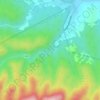
Voćin topographic map

Click on the map to display elevation.

About this map

Name: Voćin topographic map, elevation, terrain.

Location: Voćin, Općina Voćin, Virovitica-Podravina County, 33522, Croatia (45.55674 17.42125 45.64897 17.59082)

Average elevation: 386 m

Minimum elevation: 147 m

Maximum elevation: 877 m

Other topographic maps

Click on a map to view its topography, its elevation and its terrain.
Rupnica

Croatia > Virovitica-Podravina County

Average elevation: 325 m

Gear up for your next adventure:

🏃Hydration Running Vest - Carry water and maps close to your body for speed
🧥Thermal Layer - Insulating layer for cold outdoor conditions
🎒Hiking Daypack - Lightweight and durable backpacks for day trips and excursions
🧰Survival Kit - Essential gear for emergencies in the wilderness
🛶Waterproof Dry Bags - Keep electronics and clothes dry during river crossings

As an Amazon Associate, this site earns from qualifying purchases at no extra cost to you.