Geolocate

Santa Elena topographic map

Click on the map to display elevation.

About this map

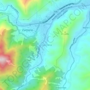
Name: Santa Elena topographic map, elevation, terrain.

Location: Santa Elena, Zamora, Zamora Chinchipe, 190101, Ecuador (-4.09425 -78.96853 -4.05425 -78.92853)

Average elevation: 1,034 m

Minimum elevation: 887 m

Maximum elevation: 1,566 m

Gear up for your next adventure:

🔪Outdoor Multitool - Versatile tool for repairs and food prep in the wild
🥾Hiking Leggings - Comfortable leggings for outdoor activities
🚲MTB Frame Bag - Carry tools and maps directly on your bicycle frame
🧢Outdoor Visor - Breathable visor for sunny hikes
🦶Hiking Shoe Insoles - Added support for high arches and long days on feet

As an Amazon Associate, this site earns from qualifying purchases at no extra cost to you.