Geolocate

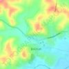
Milford topographic map

Click on the map to display elevation.

About this map

Name: Milford topographic map, elevation, terrain.

Location: Milford, Boonah, Queensland, Australia (-28.05555 152.67740 -28.00697 152.73725)

Average elevation: 193 m

Minimum elevation: 83 m

Maximum elevation: 463 m

Other topographic maps

Click on a map to view its topography, its elevation and its terrain.

Boonah

Australia > Queensland > Boonah

Average elevation: 130 m

Bicentenial Place

Australia > Queensland > Boonah

Average elevation: 114 m

Gear up for your next adventure:

🚑Survival Whistle - Signal for help across long distances in mountains
🧥Softshell Hiking Jacket - The perfect balance of wind protection and breathability
🧴First Aid Kit - Essential first aid supplies for outdoor emergencies
🔥Camping Stove - Portable stoves to cook outdoors with ease
🚲Handlebar Phone Mount - View topographic-map.com live while cycling

As an Amazon Associate, this site earns from qualifying purchases at no extra cost to you.